Recent projects
-
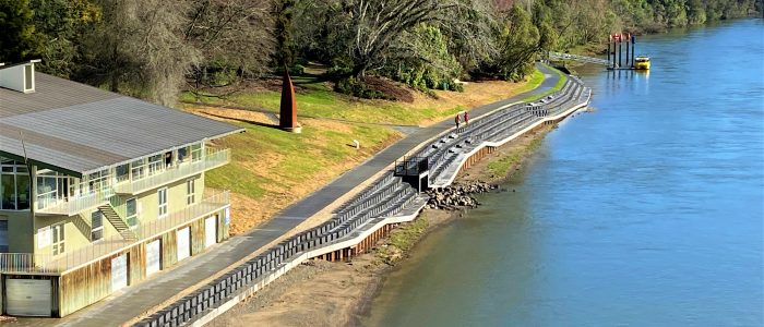
Waikato River Works
 Read more
MAP Projects was engaged by Hamilton City Council to complete 3 portions of work on the Waikato River in November 2020
Portion one consisted of the manufacture and install of a steel log deflector to protect Hamilton East bulk water main from river debris. 2x 17m piles were driven from a floating crane into the riverbed to secure the structure. The deflector also served as a new collection point for the irrigation pumps delivering water into the adjacent Hamilton gardens...
-
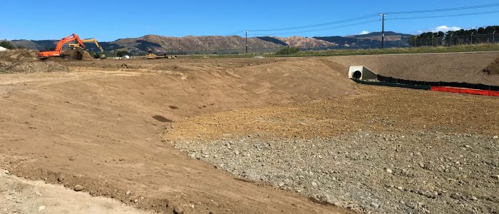
Linton Watercourse and Stormwater Network Realignment
 Read more
In 2021 MAP Projects completed a swale diversion project for Linton Military Camp. The diversion was required to enable future vertical construction within the camp. Key to the project was the excavation and shaping of 400 metres of swale nearing five metres deep...
-
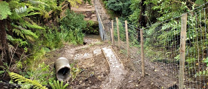
Ardmore Military Training Area Boundary Fence Upgrade
 Read more
In early August 2020 MAP Projects finished the construction of some 13km of deer fencing along the Ardmore Military Training Area (AMTA) boundary and a fully automated gate at the entry to the training facility, for the New Zealand Defence Force.
This was a project in support of impending statutory requirements for the Auckland Council’s regional pest management plan and to improve security of the training area.
The area covers a large area of hard, steep terrain that runs through dense bush and the occasional boggy creek...
-
Wairakei East Wetland (Pond G) Construction
 Read more
MAP Projects was engaged by Tauranga City Council to undertake the construction of stormwater swales and a wetlands area comprising of around 250,00m3 of earthworks and over two kilometres of access track. Culverts in four different locations were installed with a portion of the work, both earthworks and structures, undertaken below the water table.
This is a large scale project that has run smoothly in consultation with the client and its representatives and where any design issues once encountered have been dealt with in a spirit of mutual cooperation with a view of delivering the best solution within the available budget
The earthworks comprised of roughly 250,000m3 of sand and topsoil handled and reshaped with 10,000 m3 of fill area...